
Table of Contents
I’ve looked down on Sherbrooke Lake from the top of Paget Peak and even skied along its edges at the end of the Wapta Traverse. But it wasn’t until September 2025 that I finally made the time to properly hike to Sherbrooke Lake. Honestly, I don’t know why it took me so long – perhaps because this lake never seems to come up in those whispered conversations about Yoho’s best hikes – cue anything in the Lake O’Hara area.
The hike to Sherbrooke Lake might not get you excited like some in Yoho National Park. But considering it’s easy (though not flat), family-friendly, and combines well with the hike up to the Paget Lookout, I’d recommend it.
A visit to Sherbrooke Lake is especially rewarding in the fall, when the forest understory glows with colour and more of the shoreline is exposed. Earlier in the summer, higher water levels often cover much of the beach, but by autumn, sandy stretches appear – so it’s an ideal destination for relaxing or letting kids play by the water.
You might also like: Best Things to Do in Yoho National Park in Summer
This post includes some affiliate links. If you make a qualifying purchase through one of these links, I will receive a small percentage of the sale at no extra cost to you. Thank you very much for your support.
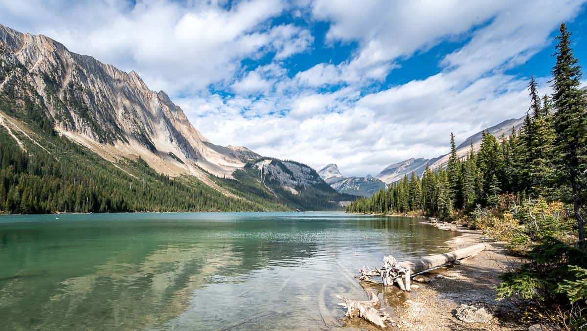
 The final approach to Sherbrooke Lake
Location map of Sherbrooke Lake
Trailhead location
From Lake Louise Village drive west on Highway 1 (also called the Trans-Canada Highway) for approximately 15 kilometres. Look for a signed turnoff to the north. From Field it’s just 11.5 km – but is not accessible if you’re traveling east. Instead, continue for another 2 km to the Lake O’Hara Road to turn around.
There is an upper and a lower parking lot. You’ll be sharing it with hikers that are heading for Paget Lookout and/or Paget Peak. The parking lots look out over pretty Wapta Lake.
There is also the option to park at the closed West Louise Lodge and take the short trail to meet up with the one to Sherbrooke Lake.
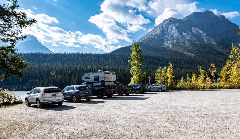 This is the upper parking lot for the Sherbrooke Lake and Paget Lookout hike
Sherbrooke Lake hike summary
Distance: 6 km )3.7 miles) round trip
Elevation gain: 197 m or 646 feet
Time needed: 1.5 – 2 hours
Difficulty: Easy, though steep with lots of roots at the start
Permits: You will need a valid Parks Canada pass. They can be bought at the Visitor Center in Field or ordered online. If you’re planning a lot of visits to Canadian National Parks over the next year, opt for the Discovery Pass, good for a year.
Dogs: Permitted on a leash.
Wildlife: It’s always prudent to carry bear spray and make noise.
Don’t forget: Even though the hike is short, pack the 10 essentials. Always practice the seven Leave No Trace principles.
Best time to hike: Late June to October
You might want: If you have balance issues hiking poles would come on handy on the steep part
Beware: From November to June beware of avalanche danger at the end of the trail to Sherbrooke Lake.
Map: Gem Trek Lake Louise and Yoho – it’s an easy hike, but the map helps put all the area trails into perspective. I also recommend Organic Maps, a free offline hiking app.
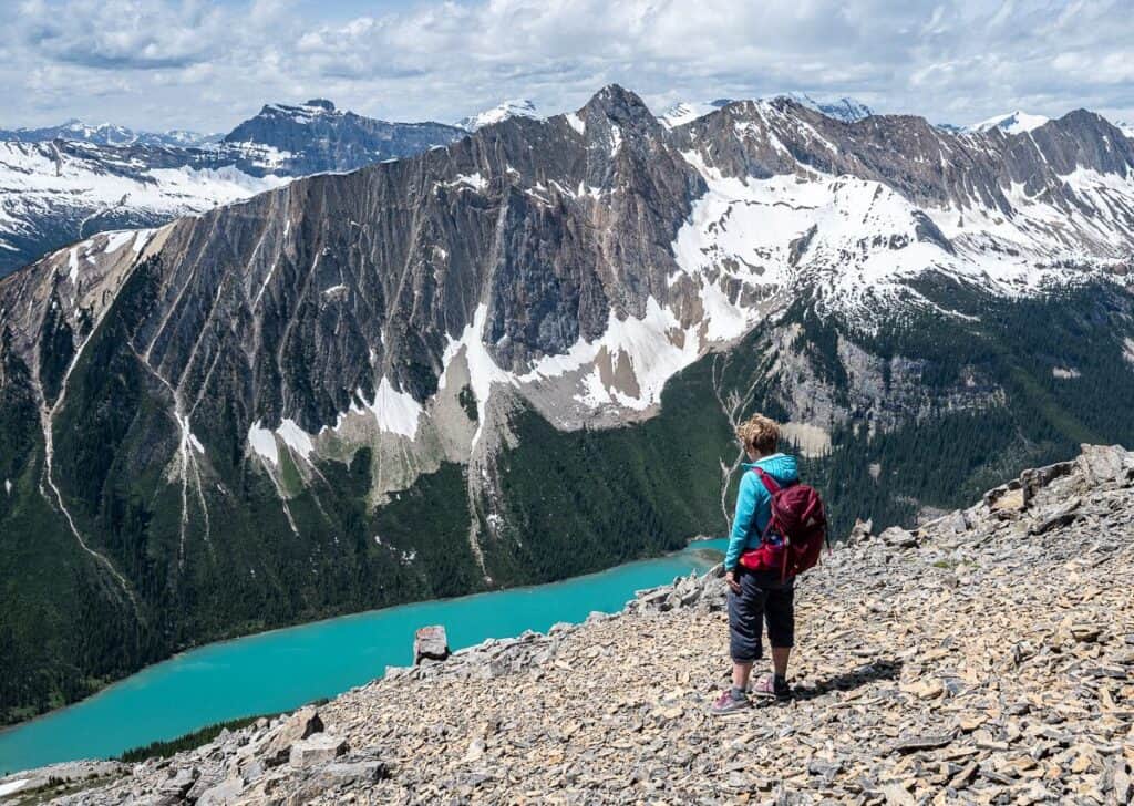 Looking down on Sherbrooke Lake from the hike to Paget Peak
Description of the hike to Sherbrooke Lake
Although the hike is an easy one, there is 165 metres of elevation gain on the first 1.4 km to the junction with Paget Lookout. After that part it’s more mellow.
To get started walk east from the parking lot and climb a few steps to a swinging door. Make sure it closes behind you and continue past an old outhouse.
Two minute’s later reach a signed junction. If you parked at West Louise Lodge, this is where you’ll meet the main trail to Sherbrooke Lake.
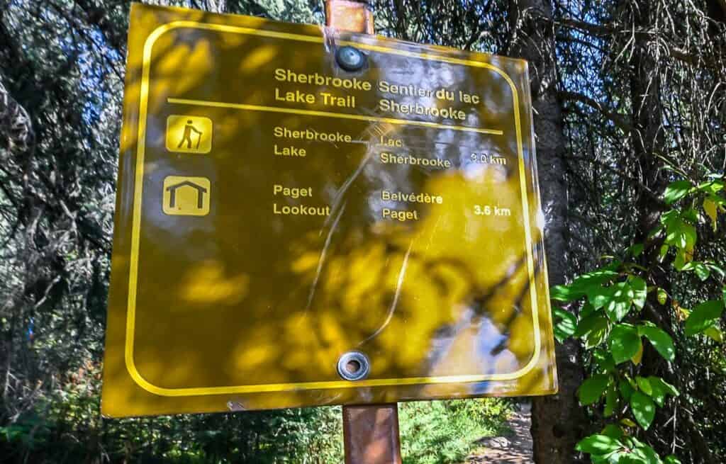 Signage at the start of the trail to Sherbrooke Lake
Start hiking up on the well-defined trail. You can see how many roots there are in the photo below. The steep sections in thick forest will get your heart pumping hard most of the way to the turnoff to Paget Lookout.
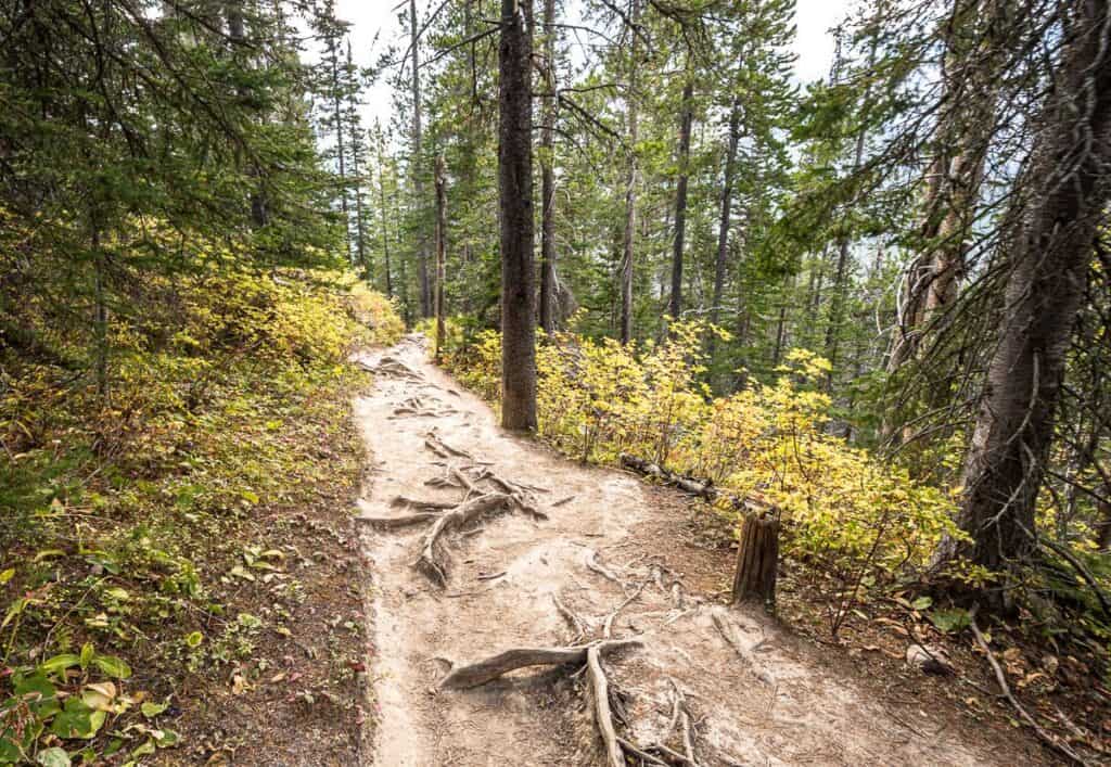 There are lots of roots at the start of the hike up to Sherbrooke Lake
 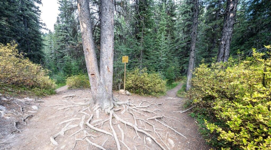 Go left at the signed intersection to continue to Sherbrooke Lake – right take you to the Paget Fire Lookout and ultimately to Paget Peak
From the intersection with Paget Lookout, the trail climbs gradually for the next half kilometre before flattening out. You’ll notice boards in place in several sections that get wet and muddy.
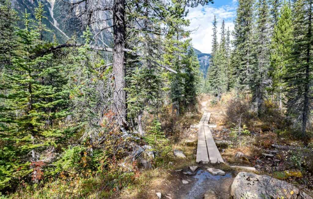 The trail to Sherbrooke Lake is generally flatter with some board sections after you pass the intersection to the Paget Fire Lookout
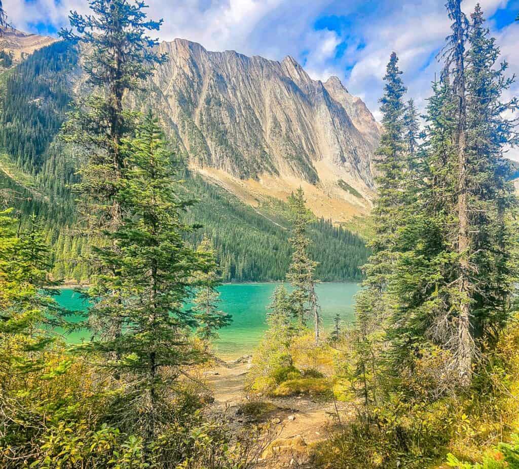
 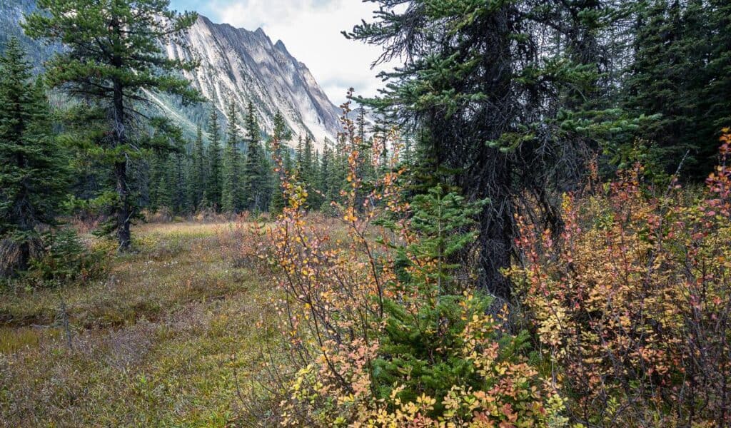 Fall colours in the meadow before you reach Sherbrooke Lake
 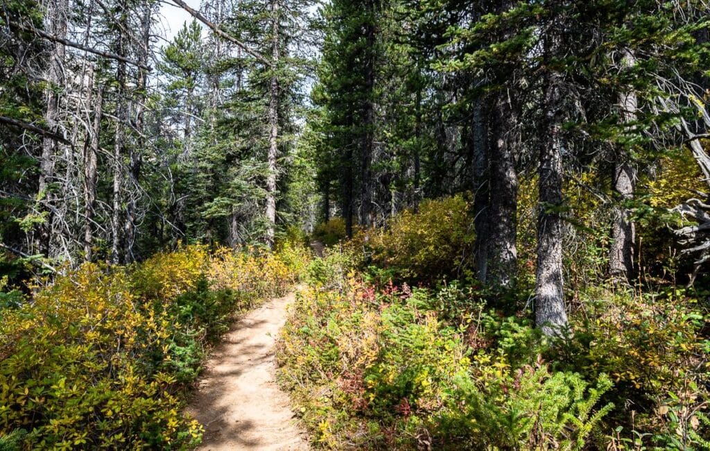 Fall is a particularly nice time to do the hike to Sherbrooke Lake, partially on account of the colourful understory
Once you reach Sherbrooke Lake, the largest backcountry lake in Yoho National Park, find a comfortable log to sit on and enjoy a break. Perhaps go for a quick, cooling dip. Or simply revel in the beauty of the area.
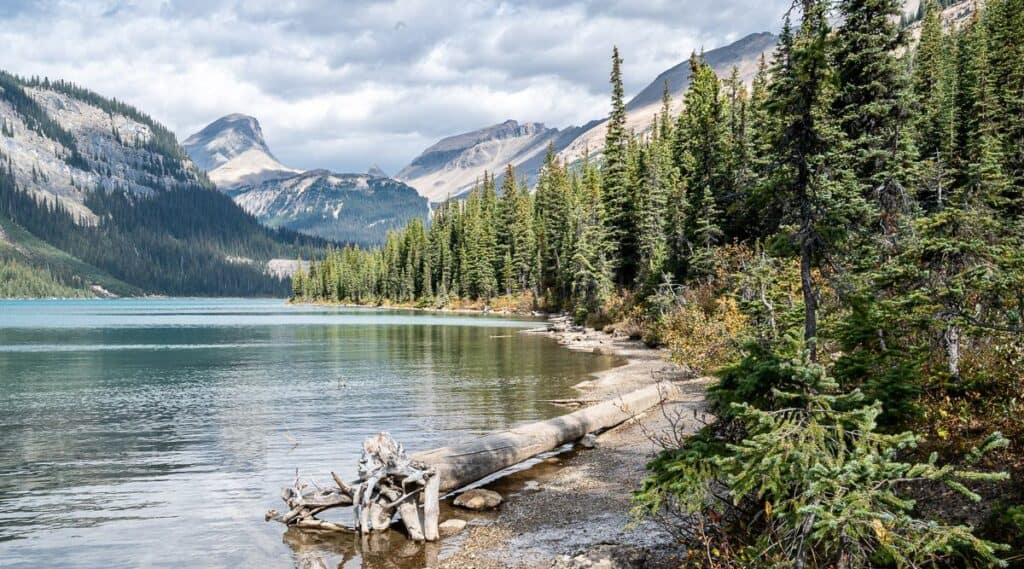 There is more shoreline later in the season at Sherbrooke Lake
Options from Sherbrooke Lake
If you don’t mind muddy, faint trails you can continue hiking for 1.4 km along the east shore of Sherbrooke Lake to reach the north end of the lake. From there climb up past streams and cascades to a meadow where you can enjoy some good views back over the lake.
If you’re into exploring, there’s even more to see from what I’ve read. Reach the Niles Amphitheatre about three hours after leaving the parking lot. If you’ve got it in you, continue to Niles Meadow where Craig Copeland says, “the panorama explodes.” However, this trail isn’t well used and can be very wet early in the season. If you elect to go as far as the amphitheatre, you’re in for a 19.6 km day!
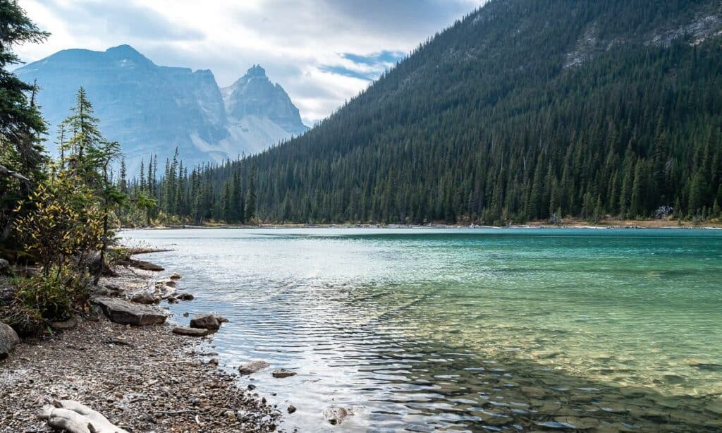 Sherbrooke Lake is a turquoise beauty
Where to stay nearby
There are several nearby camping options, with two on the road to nearby Takkakaw Falls. They offer easy access to the Natural Bridge and Field – where you can eat at the excellent though busy Truffle Pigs Bistro.
Monarch Campground is the first campground you reach on the way to Takakkaw Falls. Count on some noise as it’s closer to the highway. It’s an unserviced, first come first served campground open from early May until mid-October with the exact dates changing from year to year. There are 44 campsites best suited to tents and smaller motorhomes. The cost is $19.75 per night.
Kicking Horse Campground is at the base of Yoho Valley Road in the forest beside the Kicking Horse River. It’s also an unserviced campground, though there is washroom building with showers. It has 88 sites and costs $30.50 per night. The campground is reservable from May 30 – October 5, 2025, and is open from May 15 – October 5, 2025.
Hoodoo Creek Campground is a first come, first serviced campground open from June 12 – September 1st, 2025. The cost is $17.50, and the 30 sites are unserviced. It sits in a meadow with views of Mount Hunter. Water is not available.
Takkakaw Falls Campground is a walk-in, unserviced campground with a great view of Takakkaw Falls. It’s also a great campground to access some of Yoho National Park’s best hikes. There are 35 sites suitable for tents only. at a cost of $19.75. The campground is reservable from June 20 – September 16, 2025, but is open from June 12 – October 13, 2025.
If you want a roof over your head I highly recommend Cathedral Lake Lodge or Emerald Lake Lodge. In Field you can stay at the lodge adjoining the Truffle Pigs Bistro or at one of the many guesthouses.
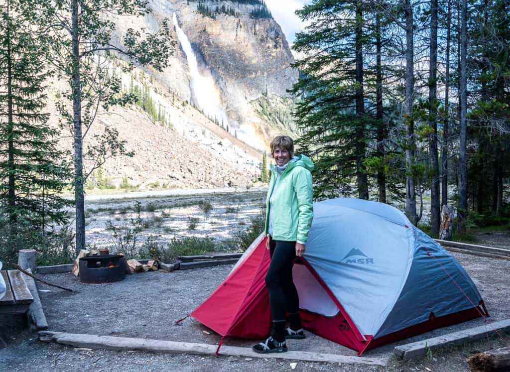 The fabulous Takakkaw Falls Campground in Yoho National Park would be a great choice as an overnight for the Sherbrooke Lake hike
More hikes in Yoho National Park you’ll love
Click on the photo to bookmark to your Pinterest boards.
Please visit:
Our Sponsor