
During our recent trip to the Big Island of Hawaii, I learned about volcanoes, since the entire island is one giant volcano, the most active on our planet. Which means we visited several locations where we got up close to volcanic fields, lava beds, craters and calderas.
Hawai‘i Volcanoes National Park offers an opportunity to learn about the volcanoes of Hawaii and visit some of the unique places related to them. The summits of two of the world’s most active volcanoes – Kīlauea and Mauna Loa – are part of the park designated International Biosphere Reserve and UNESCO World Heritage Site.
Though we visited both these famous sites, our first encounter with the volcanoes on the Big Island was in a lesser-known area of the park.
The Kahuku Unit of Volcanoes National Park
While heading south along Highway 11, we noticed a road leading up to the slopes of Mauna Loa and Volcanoes National Park. Following the road, we reached the Kahuku unit of the park.
Named for the Kahuku Ranch once in existence at the site, this area is much smaller, less developed, and less visited than the main unit of the park. We only noticed one car in the parking lot besides ours.
The reason for this might be that this unit is separate from the main park, it has only been part of the park since 2003, and the volcanic landscape here is not as dramatic – or famous.
With vegetation growing all along the trails, this side of the largest volcano on the planet looks like rolling hills rather than black lava-filled craters.
A scenic road, at times not more than a dirt trail leads to the top the area, connecting several trailheads. We drove it, and walked short distances on several trails, just to get a feel for the unique landscape, and enjoy the solitude.
The Background Story of the Unit – Why The Name Kahuku?
Before being incorporated into Volcano National Park, the area was a cattle ranch named Kahuku, established in 1861, soon after the legalization of land ownership to non-Hawaiians.
However, long before Europeans set foot in Hawaii, the area was part of the largest ahupuaʻa, division of land on the island. Ahupua’a were land sections extended from mountains to sea, organized to provide a variety of resources to a community. Since each area included both seaside and mountains, its resources included fish and salt from the sea, agricultural lands for farming taro and potatoes, and forested areas for timber and bird collection.
Ahupua’a usually had triangular shapes, with a narrow top at higher elevation and a wider base at the ocean. Their size depended on the availability of their resources. That’s why Kahuku, with its harsh lava fields on the southern slopes of Mauna Loa where nothing grew, was the largest on the island.
The word ahupuaʻa is a combination of two Hawaiian words, ahu (a pile of stones) and puaʻa (pig), because the boundaries of the divisions were often marked with a mound of rocks topped by an image of a pig, often a wood carving.
The Main Unit of Hawaii Volcanoes National Park
Though visiting the Kahuku unit was interesting, the highlight of our encounters with the volcanoes of Hawaii was in the the main unit of Hawaii Volcanoes National Park.
As soon as we crossed the gate, even the weather changed. The phrase “four seasons in one day” took on a new meaning here. Maybe not exactly four seasons, but close enough.
We started the day in a light drizzling rain, cool enough to wear long pants and a light jacket. Later in the day, as we hiked down into a crater, it got warm and sunny enough to feel like Phoenix with humidity.
After a brief stop at the Visitor Center, we drove to the overlook of Kilauea Crater, the highest point in the park.
Along the way we passed the smoking vents that reminded us of Yellowstone, and continued until we reached the road closure. We were at Uwekahuna Bluff, near the abandoned Hawaiian Volcano Observatory, damaged in the 2018 eruption of Kilauea.
It was still raining, but that didn’t stop us from stepping on a trail. Happy for the opportunity to wear the rain jacket I packed, I got out of the car and looked for a trail.
We were alone in the area, no other car even drove up to the site at the time. I noticed a trail leading to a camp site across the street, so we started there. We didn’t walk long enough to find the campground, just enough to give us a taste of the volcanic landscape in the drizzling rain.
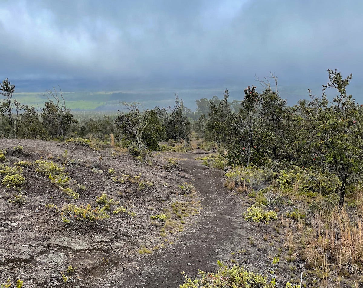 Walking along a trail near Kilauea on a rainy morning …
Kilauea Caldera
After we returned to the parking lot, we set off on the paved trail leading to Kilauea Overlook. We arrived to the overlook, just as the clouds parted, offering the most dramatic views of Kaluapele (Kīlauea caldera) and Halemaʻumaʻu crater near its edge.
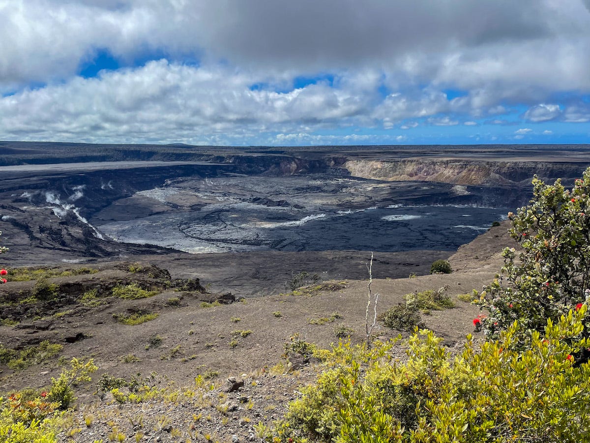 View of Kilauea Caldera from the overlook
Caldera or Crater? What Is The Difference?
While the two terms are often used as synonyms, they actually mean different things. A caldera is not a crater.
We are familiar with craters, but I’ve never seen a caldera before, and didn’t know it was something different. Craters are smaller than calderas, and more evenly circular, because they are formed by the outward explosion of a volcano.
A caldera, on the other hand, is formed by an inward collapse of a volcano, which causes it to be more uneven, even have missing sides, since land collapses unevenly.
Craters might form inside calderas, like Halemaʻumaʻu crater inside Kilauea caldera.
A bit of background on Kilauea
The world’s most active volcano mass, Kilauea’s name means “much spreading” in Hawaiian. And for good reason, since its almost constant eruptions make it spread farther and farther, adding new landmass to the island. By shape, it is a saddle volcano, an elongated dome built from lava erupting from its central crater.
Its summit that once was 4,090 feet (1250 meters) high, collapsed to form the caldera of almost 3 miles (5 km) long and 2 miles (3.2 km) wide, and about 500 feet (150 meters) deep.
The caldera’s floor is filled with recent lava flows from the Halema’uma’u Crater.
Halema’uma’u, meaning “Fern House” in Hawaiian, is Kilauea’s most active vent, the legendary home of Pele, the Hawaiian Goddess of Fire.
Pele, the Hawaiian Goddess of Fire and Volcanoes
Pele, the Goddess of Fire and Volcanoes in the Hawaiian mythology, personifies fire and volcanoes in all their forms. She is responsible for the volcanic landscape of the island, since she’s the one who sends streams of molten lava flowing from the volcanoes, destroying everything in its path.
Her story starts in the mysterious past when spiritual beings lived among us and only a thin veil divided the natural from the supernatural, the living from the dead.
Sometime during this mysterious past, Pele, Goddess of Volcanoes, arrived in Hawaii from a distant land, carrying her youngest sister, Hi’iakaikapoliopele, as an egg. Her brother Kamohoali‘i, a guardian shark, guided her travels.
After wandering for miles in search of a home for her fire and family, Pele settled in Halemaʻumaʻu crater, at the summit of Kilauea volcano.
While this is her full-time home, she sometimes visits Mauna Loa and sends rivers of lava along its slopes.
Steam Vents
The next stop along the Crater Rim Trail is the Steam Vents, visible from the Kilauea overlook. We stopped there, and it was the first place I smelt the volcano, but the smell was not what I expected.
Instead of the sulfur smell I came to associate with volcano steam vents from Yellowstone, it was a weird combination of steamed greens, boiling vegetation. I suppose it was indeed because of the steaming vegetation near the vents. I actually liked it as I got used to it.
During our wanderings through the volcanoes of the island, I encountered this smell often, in several other areas, too.
Here, we saw the steam vents that caused it.
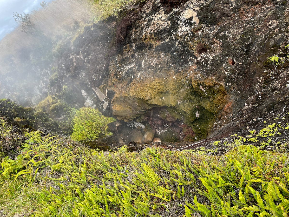 A closer look at a steam vent – vegetation so close to the heat explains the smell of steamed greenery
What Are Steam Vents?
Steam vents are created as ground water seeps down into the ground, and reaches rocks heated by magma underground. These rocks are hot enough to vaporize the water, which returns to the surface through holes and fissures as steam.
Hiking to a Caldera – On the Halema’uma’u Trail
The approximately one-mile-long trail we took starts at the Volcano House, and descends 425 feet (130 meters) through a lush rainforest to the floor of to Kilauea caldera.
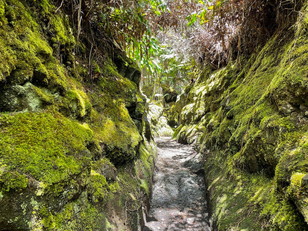 The trail took me through lush vegetation, sometimes narrow enough to form a tunnel …
Though steep, the trail wasn’t too strenuous, and gave me an opportunity to learn about the tropical forest, some of the unique plants in the area (at different spots of the trail, several signs offered information about specific plants).
Though most of it shaded and pleasant when we started, as were descending, temperatures were rising, and by the time we reached the bottom, I felt an almost-Phoenix-desert heat.
Standing on the black lava bed was a surreal experience. It was too sunny to walk across, so we contended to walking only a few feet on the lava bed. I stood for a while, taking in the view, the vast extent of lava forming swirls and shapes on the caldera’s floor.
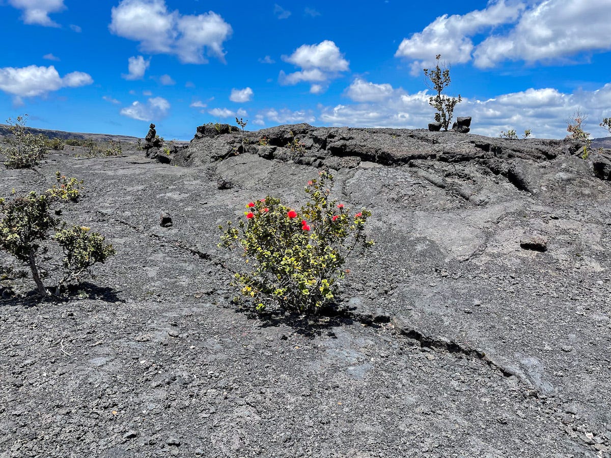 On the surface of the crater…
I love the ‘ohi’a’lehua, this unique bush with bright red flowers in sharp contrast to the black surroundings. As I learned on this trip, it is the first plant that grows on the lava. Once the lava cools, its tiny seeds settle in the smallest of crevices, get established, and eventually grow into trees.
The hike back was not as hard as I expected, and instead of huffing and puffing, I enjoyed the tropical forest environment, with its huge ferns and unique trees.
Along the Chain of Craters Road
The Chain of Craters Road was one of the highlights of my visit to Volcanoes National Park.
The 19-mile scenic road follows the lava flow into the ocean. Every mile of that road is spectacular; even while offering the same views from slightly different angles.
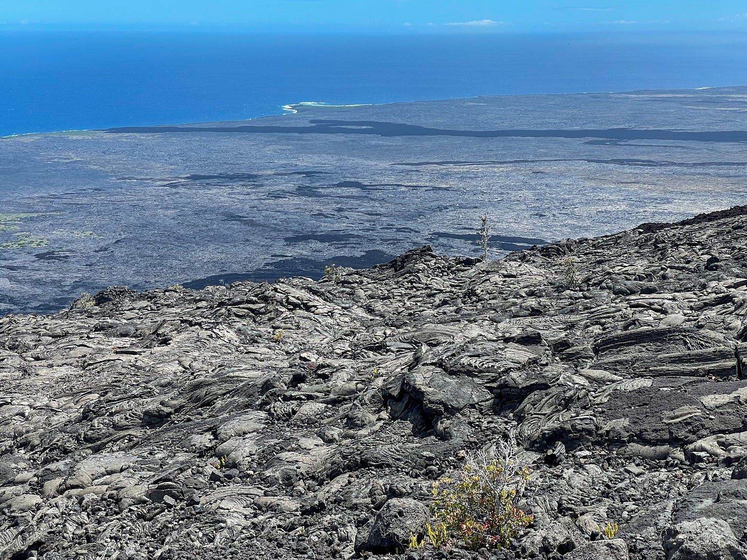 View of the ocean shore from mid-way down along the Chain of Craters Scenic Road
An extension of Crater Rim Drive, the Chain of Craters Road, descends to the ocean from about 4,000 feet elevation. Along the way, it passes through lava fields of different ages, different consistencies, interspersed by several green areas with vegetation.
What you see most is lava, though, with few patches of vegetation. Black lava swirls and rough lava formations, all in different shades of black, and occasional rust color.
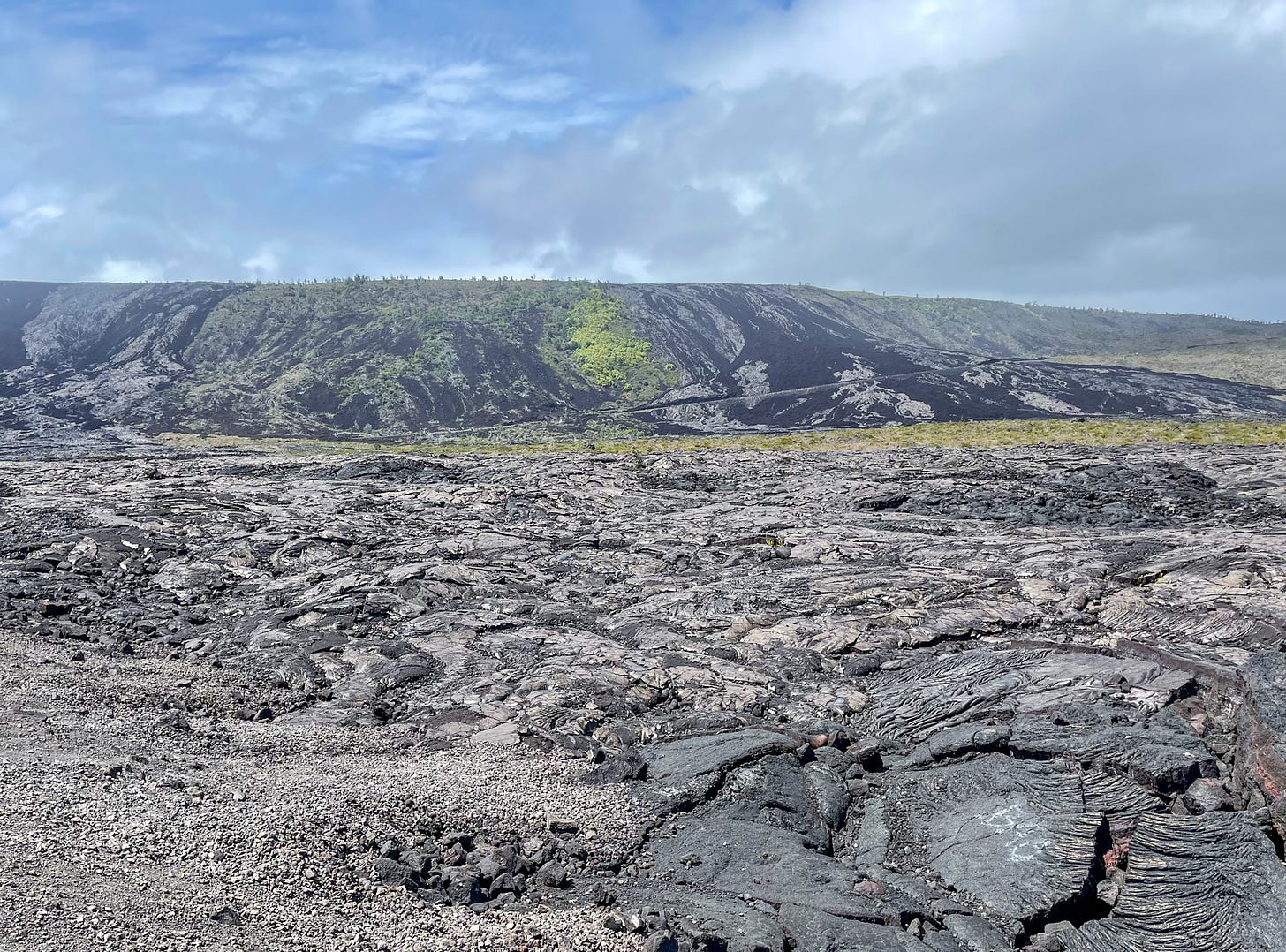 Lava in all shapes and sizes form the lava field and a clear views of lava flows along the Chain of Craters Scenic Road
We are no strangers to lava flows and craters, since we live close to Sunset Crater Volcano National Monument and visit it often. But the Bonito Lava Flow at Sunset Crater is a tiny baby lava flow compared to what we saw here.
Here, on these seemingly never-ending lava fields that added miles to the Big Island of Hawaii in recent years, we saw every kind of lava. We recognized its flow, like a giant thick black river making its way into the ocean.
I prefer the look (and feel) of the smooth, rolling swirls of Pahoehoe lava I’ve only seen in pictures until now. I am more familiar with the rough surface of the a’a lava we see at Sunset Crater, and noticed it here, as well.
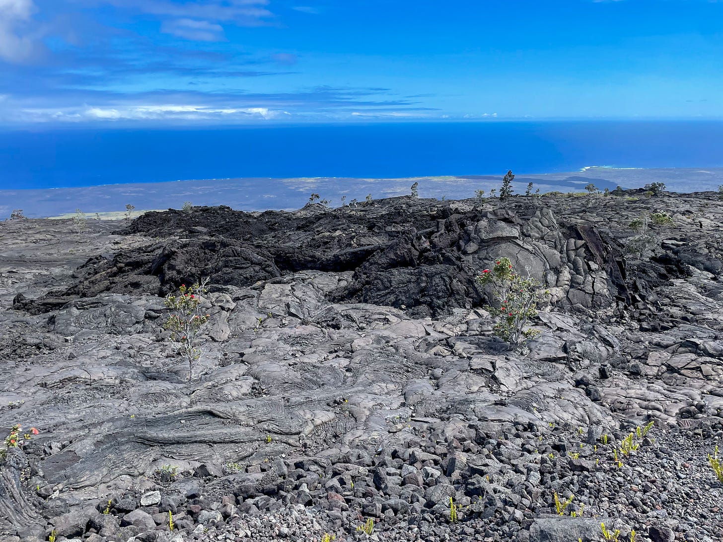 Smooth swirls of Pahoehoe lava and rough, broken a’a lava are both part of this giant lava flow making its way into the Pacific
The black landscape changes constantly as you drive across this enormous lava field. Several stops offer an opportunity for a closer look at different formations and craters.
But nothing beats the view of the lava flowing into the ocean. Here, at the end of the road, we walked out to the water’s edge for an unforgettable view of the Holei Sea Arch of lava rock, along with steep cliffs of black dried lava dropping into the Pacific.
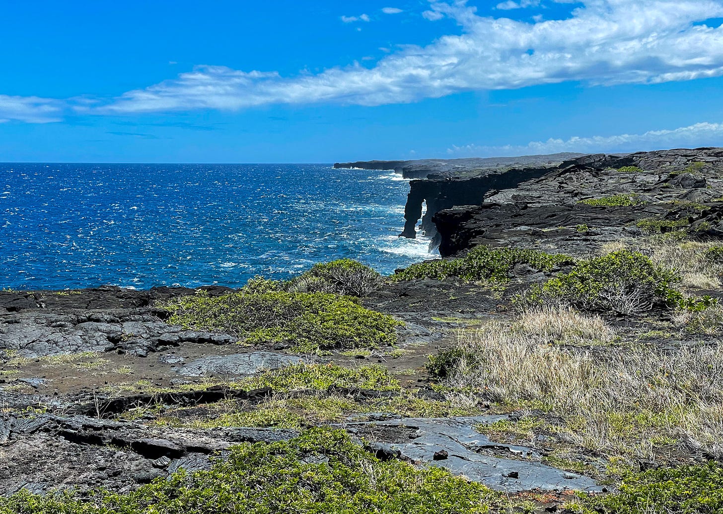 View of the Holei Sea Arch from the and of the road.
We drove part of the scenic road twice. While the first time it was sunny and too warm for walks except at the very end, the second day was much cooler and cloudy, offering a different perspective of the same landscape.
A Bit of Background History of the Road
The Chain of Craters Scenic Road has an interesting history, starting in 1928, when the National Park built the original, to connect Crater Rim Drive to Makaopuhi Crater. In 1959, they lengthened it to the coast to reach the tiny town of Kalapana. The town no longer exists, destroyed and buried by lava flows in 1990.
Lava flow from the Makaopuhi eruption buried part of the road in 1969, only ten years after its completion. Another ten years passed, until the road reopened in 1979. Since then, most of it is the same. At least until it reaches the coast.
The coast was once home to several villages since the first human settlements on the island. Trails, home sites, petroglyphs (some of which you can reach at the end of a trail from the road today), and agricultural sites are still remnants of their existence. At least those not buried under the lava.
The first luakini heiau (temple designated for human sacrifices) built in the 13th century and used until 1819, was also part of Volcanoes National Park since 1938, with a Visitor Center built in 1966. All of it is buried under the lava, destroyed during the volcanic eruption of Pu’u’o’ho that lasted 35 years, from 1983 to 2018.
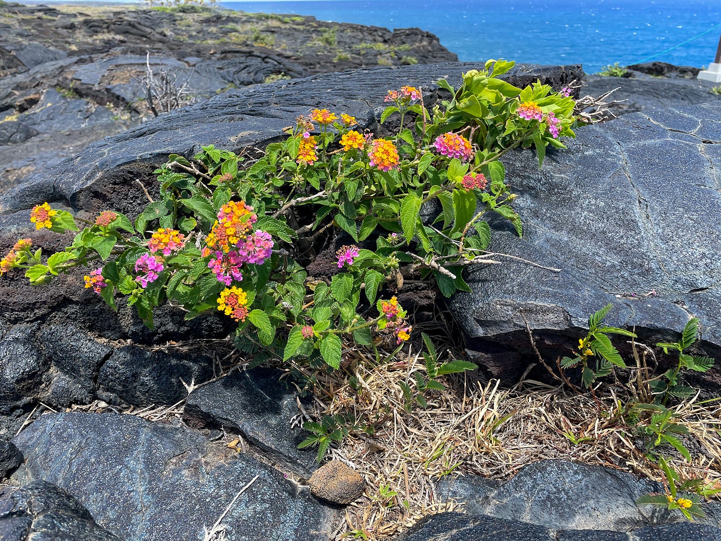 I enjoyed seeing flowers bloom in the cracks of the lava flow near the Holei Sea Arch Viewpoint, adding a splash of color to the surroundings.
Today, the road stops when it reaches the coast, with about a mile of it blocked off before the volcano slide that ran across it and destroyed it.
Mauna Loa, the Largest of the Volcanoes of Hawaii
The largest active volcano on the planet, Mauna Loa, is a shield volcano, elongated, with large, rounded slopes. Its shape is caused by the type of eruptions that formed it, with a high volume of flows producing lava capable of traveling long distances.
Last time it erupted in 2022.
Eruptions most often begin in its main summit caldera called Moku‘āweoweo. From there, they migrate to the two rift zones, to the northeast and southwest. These two rift zones are historically very active, sending out flows toward the city of Hilo (latest in 1984) and South Kona (in 1950).
Since they started monitoring its eruptions in 1843, Kilauea erupted 34 times, about once every five or six years.
The largest, most destructive eruption in Hawaii’s known history occurred in thespring of 1868. Starting at the summit caldera, it lasted five days, and destroyed villages, grazing land, and caused the death of many islanders.
Later eruptions weren’t as deadly, but they all caused changes in the landscape of the not only the mountain, but the whole island.
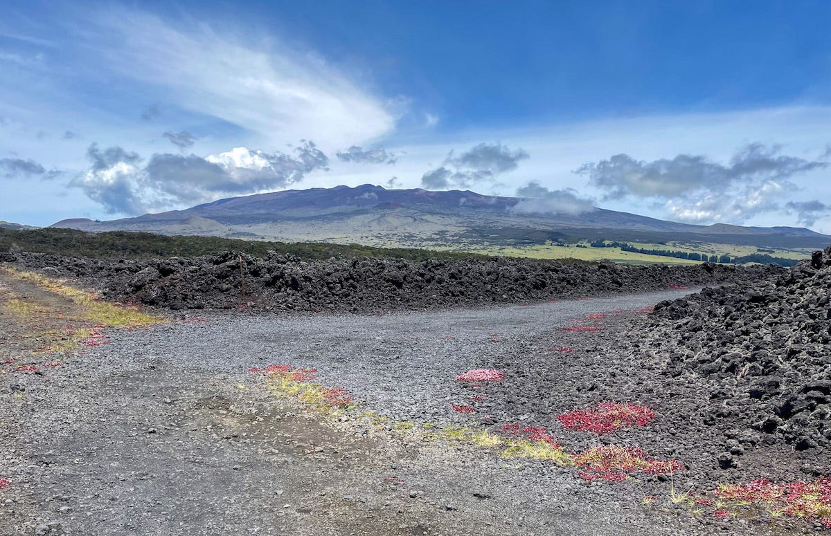 View of Mauna Loa
The enormous volcano makes up more than half (about 51%) of the Big Island of Hawaii, standing 13,681 feet (4,170 m) from sea level. However, its height, calculated from the bottom of the ocean, is higher than Mount Everest, at 30,000 feet (9,144 feet).
Closer Look at Mauna Loa
With a four-wheel-drive vehicle it is possible to drive up to the summit of Mauna Loa. However, we didn’t have one, so we stopped at the Visitor Center.
Past it, the road turns to hard-to-navigate dirt and you can only drive a four-wheel vehicle higher up. The rangers made sure no one in a smaller vehicle drove to the summit. They also made sure everyone who was driving higher would spend at least 30 minutes at the Visitor Center level, to help with acclimatization to the height.
We enjoyed the views and the much cooler weather at the Visitor Center Level, didn’t feel the need to go up higher. We couldn’t have, anyway, unless we hitched a ride with someone with a four-wheel vehicle. I watched a couple do that, so I’m sure it is common practice.
Signs of Volcanoes on the Big Island Are Everywhere
Hawaii Volcanoes National Park showcases the volcanoes of the Big Island, and offers a possibility to learn about them. However, you don’t need to go there to see signs of volcanoes on the Big Island: they are everywhere.
In fact, you see them as soon as you land in Kona, since the airport itself sits on a huge lava bed. At first glimpse of the island, all you see is ocean and lava.
Along the coast, everywhere you go, you see lava rock near the ocean, even on the largest white-sand beaches.
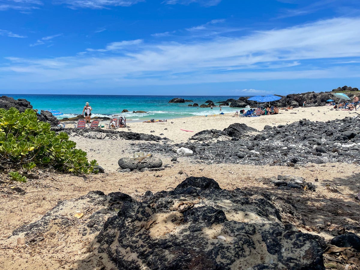 Signs of volcanoes are everywhere on the island: lava on a white-sand beach
However, you can also find areas with lush, dense vegetation, rivers and waterfalls. Volcanic soil, given enough time, is one of the most fertile soils on the planet.
The Big Island showcases not only the largest and most active volcanoes on the planet, but unique flora and fauna that can only grow here, and a rich cultural history.
The original version of this article appeared in my Substack newsletter, Letters from a Wanderer. For more up-to-date stories sent directly to your inbox, consider signing up to the newsletter.
Please visit:
Our Sponsor
